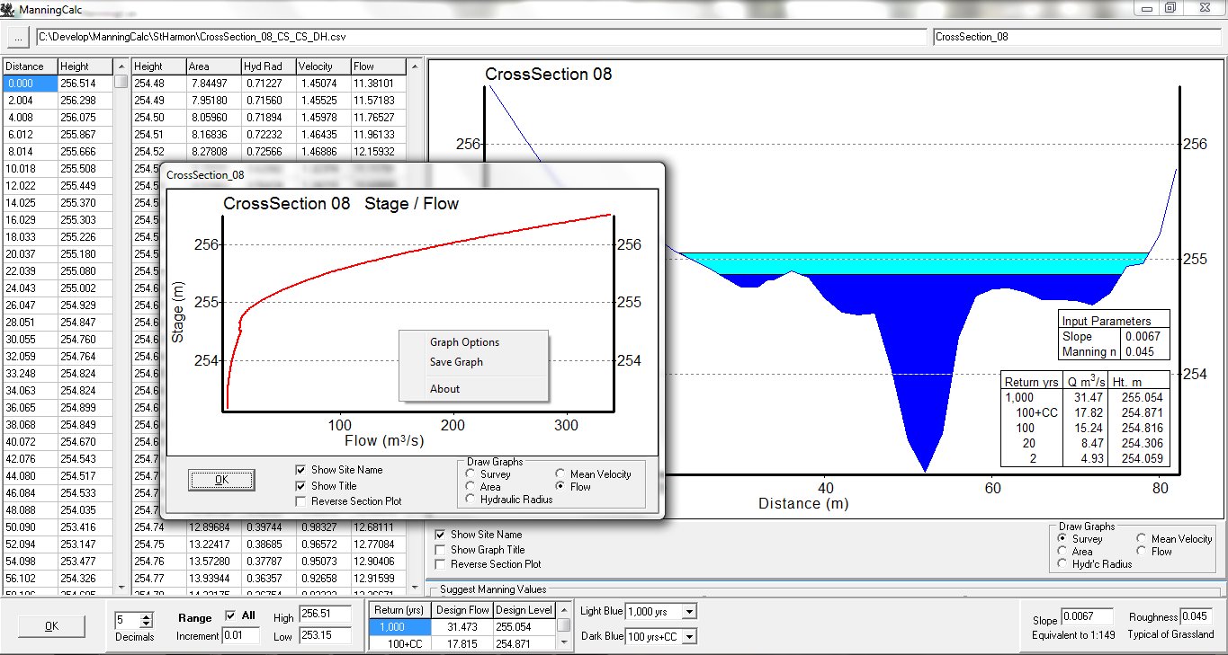
Survey data should be arranged in columns of distance and height in a *.CSV file. It could be exported from a section in ViewDEM or entered some other way. Having found the cross-sectional area and the hydraulic radius at each water depth, the program the uses the channel slope and roughness entered by the user to find the mean water velocity and flow at the cross-section, using the Manning Equation. The user can then enter values of design flow at any given return period and the program calculates corresponding design levels. The cross-section above was exported from ViewDEM and design flow values calculated using WinFAP / FEH. The method is not as accurate as hydraulic modelling. It has been used sucessfully in Flood Consequence Assessments to define the word "obviously", when used in the sentence "obviously outside the flood zone".